Contents
Overview
The concept of a geostationary orbit, a celestial parking spot that keeps a satellite perpetually above a single point on Earth, was first articulated with prescient detail by science fiction author Arthur C. Clarke. Precursors to this specific orbital mechanics understanding can be traced back to the work of early rocket pioneers like Robert Goddard and theoretical physicists like Konstantin Tsiolkovsky, who laid the groundwork for spaceflight. The actual realization of a geostationary satellite, however, had to wait for the development of powerful rockets and sophisticated tracking systems. The Soviet Union's Molniya satellites explored highly elliptical orbits for near-polar coverage, but it was the American Syncom program that achieved the first true geostationary orbit with Syncom 3 in August 1964, enabling the first live transatlantic television broadcast during the Tokyo Olympics.
⚙️ How It Works
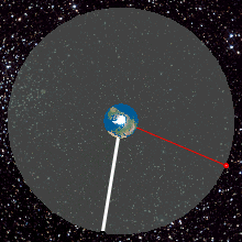
A geostationary orbit is achieved by placing a satellite in a circular path 35,786 kilometers (22,236 miles) above Earth's equator, precisely matching Earth's rotational period of approximately 23 hours, 56 minutes, and 4 seconds (one sidereal day). This synchronization means the satellite's angular velocity equals that of the Earth, causing it to appear stationary from any point on the ground. The satellite must also orbit in the same direction as Earth's rotation, from west to east. Achieving this precise altitude and velocity requires immense energy, typically necessitating heavy-lift launch vehicles like SpaceX's Falcon Heavy or Ariane 5. Once in orbit, small thrusters are used for station-keeping maneuvers to counteract gravitational perturbations from the Sun and Moon, and atmospheric drag, ensuring the satellite remains within its designated orbital slot.
📊 Key Facts & Numbers
The geostationary belt, a ring of orbits around the Earth's equator, is a remarkably crowded space, hosting over 500 operational satellites as of early 2024, according to the Union of Concerned Scientists' Satellite Database. These satellites represent a significant portion of the global satellite market, valued at tens of billions of dollars annually. The cost of launching a single GEO satellite can range from $100 million to over $300 million, depending on the satellite's size and the launch vehicle used. This orbital band is crucial for services that require continuous coverage, with approximately 70% of all commercial communications satellites operating in GEO. The total mass of operational GEO satellites is estimated to be in the hundreds of thousands of kilograms, a testament to the scale of this orbital infrastructure.
👥 Key People & Organizations
Key figures instrumental in the development and utilization of geostationary orbits include Arthur C. Clarke, whose visionary writings popularized the concept. Harold Rosen, an engineer at Hughes Aircraft Company, was a principal architect of the Syncom satellites, the first to achieve geostationary orbit. Bernard Schwab played a critical role in managing orbital slots for the International Telecommunications Satellite Organization (Intelsat), one of the earliest and largest GEO satellite operators. Major organizations like Intelsat, Eutelsat, SES, and Telesat have built vast fleets of GEO satellites, dominating the telecommunications and broadcasting sectors. Government agencies such as NASA and the European Space Agency (ESA) also utilize GEO for scientific missions and Earth observation.
🌍 Cultural Impact & Influence
Geostationary satellites have profoundly reshaped global society, making instantaneous worldwide communication and broadcasting a reality. The advent of GEO satellites enabled the widespread adoption of satellite television, bringing diverse programming to remote corners of the globe and fundamentally altering media consumption. They are the backbone of international telephone calls, internet services in underserved regions, and global financial transactions. Furthermore, weather satellites in GEO, like those in the GOES and Meteosat series, provide continuous, real-time imagery of weather patterns, crucial for forecasting and disaster management, saving countless lives and billions in damages. The cultural impact is immense, from facilitating global news coverage to enabling remote work and education, weaving GEO satellites into the fabric of modern life.
⚡ Current State & Latest Developments
The geostationary belt is becoming increasingly congested, leading to concerns about orbital slot availability and the growing threat of space debris. Companies like SpaceX with its Starlink constellation and OneWeb are deploying thousands of satellites in Low Earth Orbit (LEO), offering lower latency and higher bandwidth, which presents a competitive challenge to traditional GEO services. However, GEO satellites continue to be essential for applications requiring wide-area coverage and fixed-point communication, such as broadcasting and critical infrastructure monitoring. Recent developments include the deployment of larger, more powerful satellites with advanced capabilities, such as high-throughput satellites (HTS) offering significantly increased data capacity, and the exploration of electric propulsion for more efficient orbit raising and station-keeping. The International Telecommunication Union (ITU) continues to manage orbital assignments, a complex diplomatic and technical challenge.
🤔 Controversies & Debates
The primary controversy surrounding geostationary orbits centers on orbital congestion and the increasing risk of collisions. As more satellites are launched, the finite number of usable orbital slots becomes a critical resource, leading to geopolitical tensions and disputes over spectrum allocation. The space debris problem is particularly acute in GEO, where defunct satellites can remain in orbit for centuries, posing a threat to operational spacecraft. Critics also point to the high cost and long lead times associated with deploying GEO satellites compared to the rapidly evolving LEO constellations. Furthermore, the reliance on GEO for critical services raises questions about resilience in the face of potential attacks or catastrophic failures, prompting discussions about diversifying orbital assets and developing more robust space traffic management systems.
🔮 Future Outlook & Predictions
The future of geostationary orbit satellites will likely involve a hybrid approach, coexisting with burgeoning LEO constellations. Innovations in satellite design, such as modular architectures and in-orbit servicing capabilities, could extend the lifespan and utility of GEO assets. The development of more efficient propulsion systems, like electric propulsion, will reduce launch mass and cost. There is also growing interest in using GEO for new applications, including space-based solar power transmission and advanced Earth observation missions requiring persistent surveillance. As the demand for global connectivity and data services continues to grow, GEO satellites will remain vital, though their role may evolve to complement, rather than solely lead, the satellite communications landscape. The ongoing challenge will be managing this valuable orbital resource sustainably and equitably for future generations.
💡 Practical Applications
Geostationary orbit satellites are indispensable for a wide array of practical applications. They are the backbone of satellite television broadcasting, delivering hundreds of channels to homes worldwide via fixed antennas. In telecommunications, they provide essential connectivity for remote areas, maritime vessels, and aircraft, bridging digital divides. For weather forecasting, GEO satellites offer continuous monitoring of atmospheric conditions, enabling timely warnings for hurricanes, typhoons, and other severe weather events. They are also used for global positioning systems (thoug
Key Facts
- Category
- technology
- Type
- topic